Recap
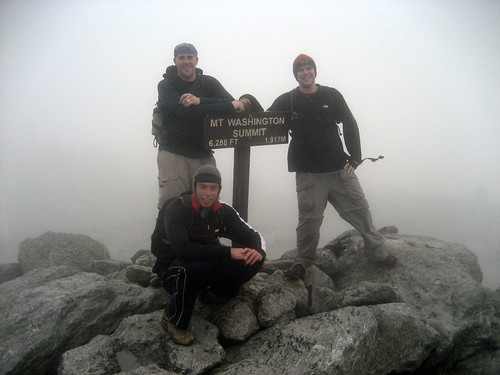
After a few cancellations due to bad weather, we finally got a window of opportunity to hike up Mt. Washington. The highest peak in the White Mountains, Washington soars to just about 6300 feet at the summit.
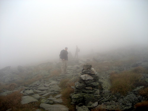
By a “window of opportunity” I mean waiting for weather conditions that wouldn’t kill us. Mount Washington is home to the world’s worst weather, and we didn’t want to take that lightly. The day started off very well, with fairly clear skies and a view straight up to the top. However, as the morning turned into afternoon, clouds came through and covered the summit. As a result, we hiked the final two miles to the summit in a thick fog with only a couple hundred feet of visibility. Combined with the wind and drizzle, it was quite an experience.
Hiking Washington is bittersweet – due to the auto road and the cog railway, the summit is crowded with tourists. It’s tough to feel like you’ve accomplished much when you get to the summit and you’re able to use a flush toilet, eat pizza and clam chowder, and buy a t-shirt. On the other hand, knowing you’ve just climbed the highest peak in the Northeast is a great feeling.
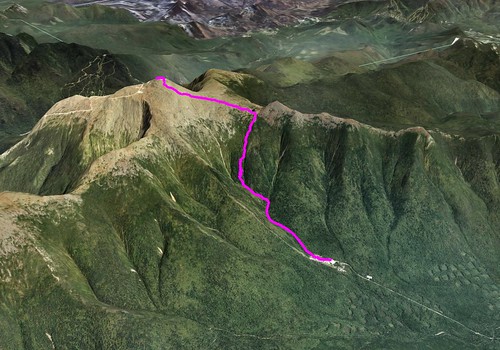
Route
- Ammonoosuc Ravine Trail from Marshfield Station parking lot to Lakes of the Clouds Hut - 2.5 miles
- Crawford Path from Lakes of the Clouds Hut to Mount Washington Summit - 1.5 miles
- Crawford Path from Mount Washington Summit to Lakes of the Clouds Hut - 1.5 miles
- Ammonoosuc Ravine Trail from Lakes of the Clouds Hut to Marshfield Station parking lot - 2.5 miles
Total distance: 8.0 miles
Video
Pictures
Full gallery here.